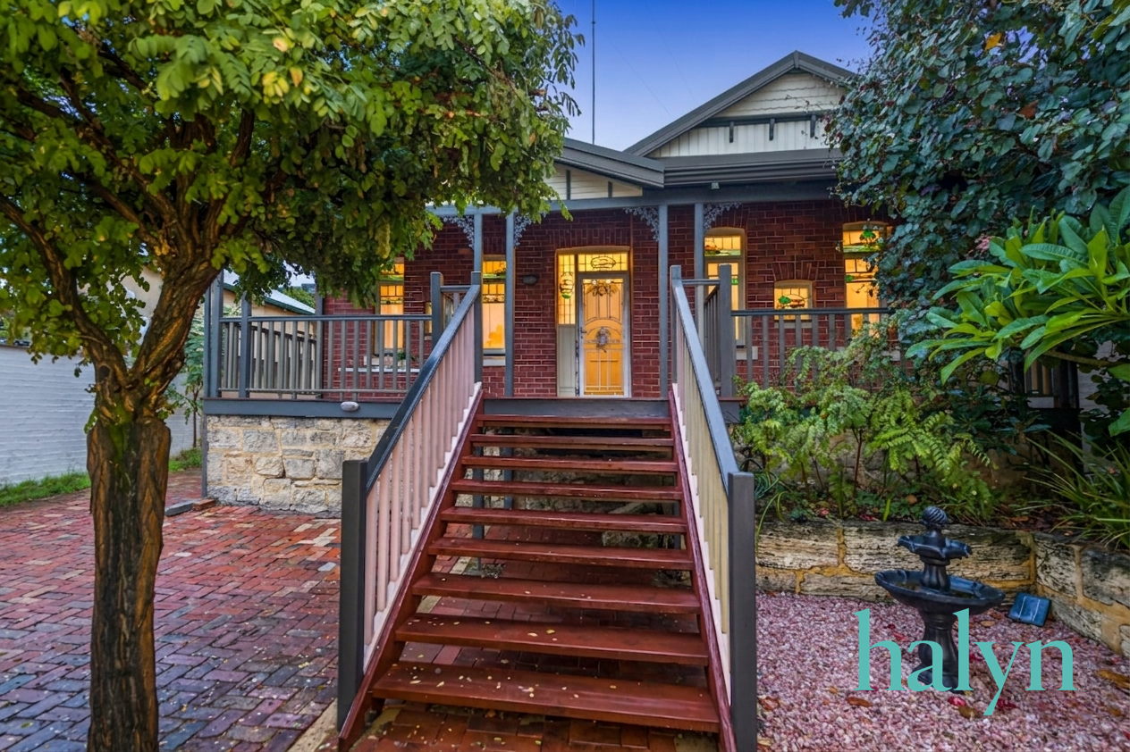
108A Mackie Street
AI Property Assistant
Instant insights — ask StMate AI anything about this property
Based on recent comparable sales in Victoria Park
AI Property Assistant
Ask anything about this property
Property Insights
Multi-dimensional analysis · last updated 06/05/2026
Schools
7 nearby schools
Catchment: Victoria Park Primary School
Zoning
R20 — Residential Zone (R20)
Town of Victoria Park Local Planning Scheme No. 2
Public transport
Data unavailable
Traffic
Moderate congestion
Peak hour traffic (7-9 AM and 4-6 PM) on Albany Highway and Shepperton Road increases congestion on connecting local streets. Mackie Street experiences moderate delays during these periods due to through-traffic and commuter movements toward the CBD.
Flood risk
Low
Victoria Park is a low-lying eastern Perth suburb in the City of Canning, situated between the Canning River to the south and urban drainage systems. While not located within a major flood-prone catchment comparable to Queensland or NSW river systems, the suburb's proximity to the Canning River and flat topography warrant standard stormwater and flood-risk due diligence during development. Western Australia's planning framework does not employ formal state-wide flood overlays like those used in other states, relying instead on local flood studies and DWER recommendations.
Bushfire risk
Low
BAL: BAL-LOW
Crime profile
above average
Trend: stable
Nearby development
5 projects nearby
Victoria Park is experiencing moderate infill development and urban renewal activity, driven by proximity to Perth CBD, the railway station, and integration with adjacent Burswood Park. Development focus is on mixed-use, medium-density residential and transit-oriented projects targeting inner-city liveability. Council is supporting incremental densification through dual occupancy approvals and precinct-scale improvements.
Heritage
Heritage listed
Victoria Park is an inner-city Perth suburb with significant local heritage character, featuring early 20th-century residential properties and the heritage-listed parkland. Many properties fall within a local heritage conservation area managed by the City of Perth, with development controls designed to preserve the Edwardian and Federation-era streetscape. Individual heritage listings and broader precinct protections apply to notable properties throughout the suburb.
Property Photos
Property Features
Location & Nearby
Approximate location shown. Contact agent for exact address.
AI Neighbourhood Insights
Property Report
Traffic, zoning, flood risk & more
Property Details
- Property Type
- house
- Listing Type
- For Sale
- Bedrooms
- 3
- Bathrooms
- 1
- Parking
- 1
- Land Area
- 138m²
- Listed
- 2 days ago